
Snowpack levels in the San Juan Mountains of southwestern Colorado typically peak in April or early May, before starting a rapid downward slide as temperatures rise and spring runoff gets underway. This water year — which so far has tracked just below average in terms of snowpack — appears to be following the “normal” pattern. Yet it also continues a trend of earlier, and diminishing, snowpack-peaks.
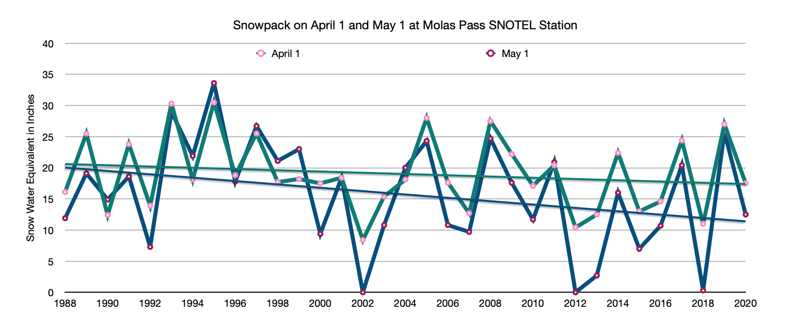
For the last few years I’ve been following, graphing, and posting snow water equivalent levels at three high-altitude SNOTEL stations: Columbus Basin, located in the La Plata Mountains west of Durango; Red Mountain Pass; and Molas Lake (near Molas Pass). Looking back at the graphs one thing that immediately stands out is that there is no “normal.” Terrifyingly dry years (2018) are often followed by wickedly wet ones (2019).
However trends do appear. Notice in the graphs below that although the snowpack level for the first of April and May fluctuate wildly from year-to-year, the overall trend line is on a downward slope. Also note that in the ’80s and ’90s the levels on May 1 were as likely to be higher than on April 1, but as time goes on, the peak tends to be earlier. This would appear to be a sign of a warming, drying climate (at least for this admittedly small sample size and short period of record).
Something not seen in these graphs: A hot early May has melted a lot of snow. If the current melting rate continues, there won’t be any snow left by June. And that could mean that the Animas River already hit its peak, topping out at about 2,200 cfs on May 5. That would be a pretty disappointing spring runoff. The warm temperatures have also put most of the region into some level of drought conditions, despite the near-average-snowfall this winter.
Of course, you never know what might happen this time of year in the San Juans. Temperatures could fall, and big storms might still hit. But don’t count on it.

1 Comment