This is a page where readers of River of Lost Souls: The Science, Politics, and Greed Behind the Gold King Mine Disaster will find various resources that will hopefully add to, or help readers navigate through, the book’s text. I’ll be putting maps, photos, diagrams, original documents and sometimes just my own thoughts up here in no particular order.
Unfortunately, I was unable to embed this timeline into this page, so you’ll have to leave to take a look. But it’s my attempt to lay out the whole history in one place.
ACID MINE DRAINAGE
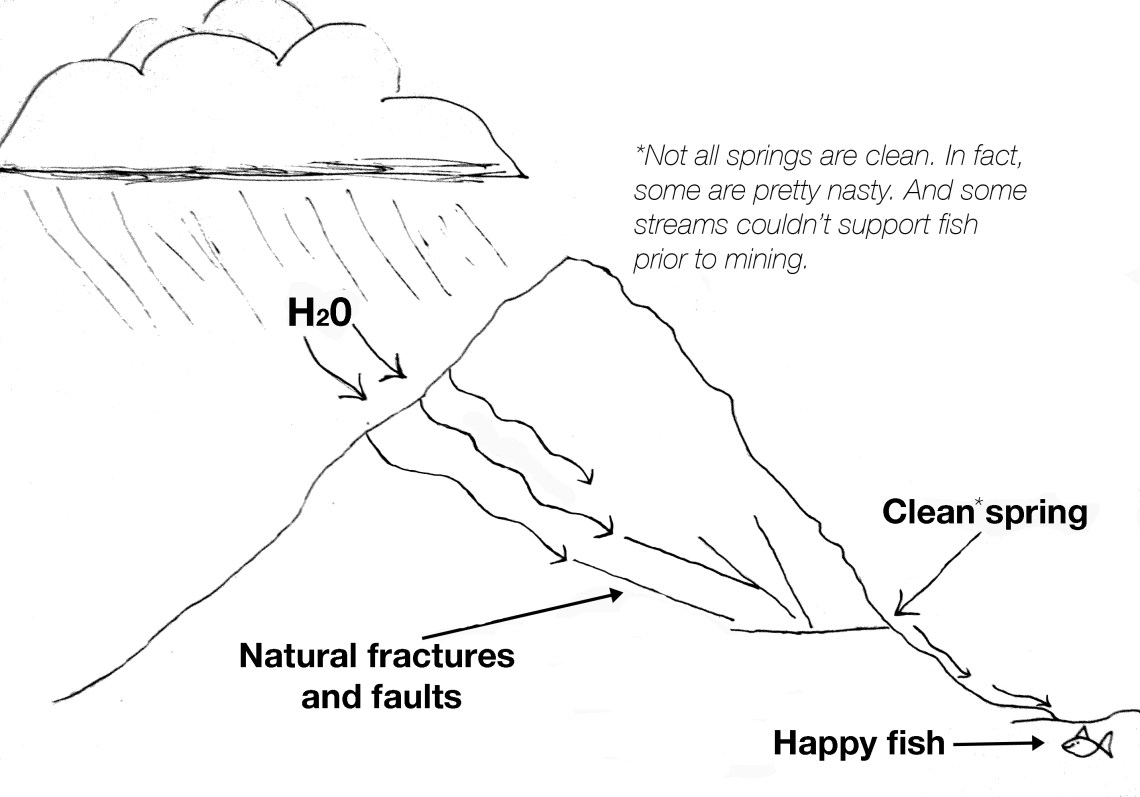
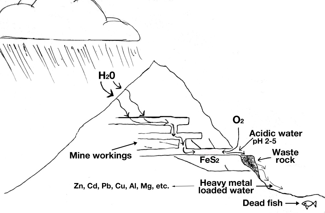
A simple, and simplified, view of how acid mine drainage works:
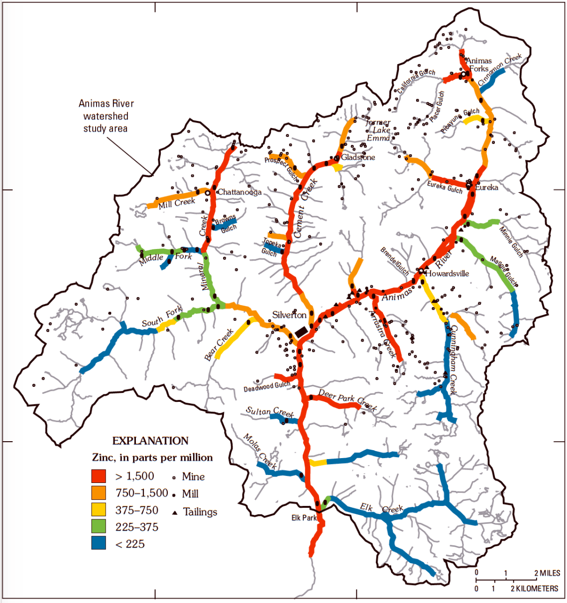
Pre-mining hydrology.Post-mining hydrology, resulting in acid mine drainage.This shows the relative hardiness of various organisms when it comes to pH levels in water. Remember that the higher the pH, the lower the acidity. Ideal pH is around 6.5. Water draining from the Gold King Mine has a pH of 2.5. Cement Creek can run as low as 3.5 pH, making it virtually uninhabitable to all but extremophiles. Keep in mind that acidity is not the only harmful component of acid mine drainage; heavy metal loading is often worse.This map, put together by the USGS, shows concentrations of zinc, a heavy metal that is toxic to fish and that is a good indicator of other metals, in the upper Animas River and its tributaries. The black dots are mines, mills, and tailings piles. Note that some stream segments have low zinc loads, despite the presence of mines.
Naturally-occurring acidity and metal loading. Whenever discussing acid mine drainage, heavy metal loading, and mine-related pollution, particularly in a place with geology like that in the Silverton Caldera and Upper Animas River Watershed, one must always remember that before any miners set foot in the area, the streams were already tainted. Cement Creek always ran orange from time to time, thanks to the iron hydroxides that are so abundant in the local geology, and lower Mineral Creek probably always ran milky green thanks to naturally-occurring aluminum. Fish never would have been able to live in those stream segments and never will, regardless of how thoroughly mine-related sites are cleaned up.
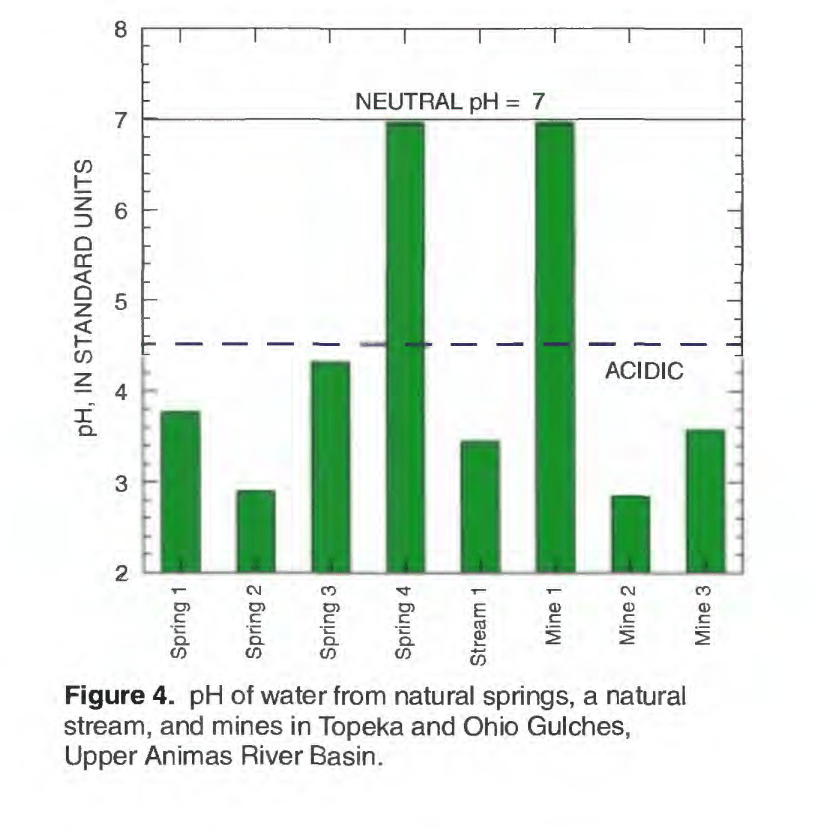
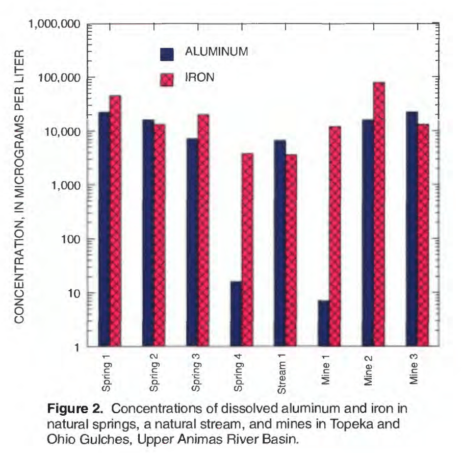
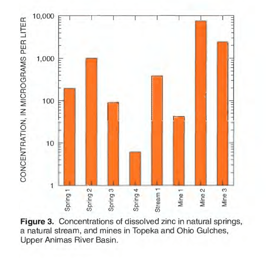
One study, conducted by Durango hydrologist Win Wright for the US Geological Survey, found that some natural springs, that had not been affected by mining at all, were highly acidic (low pH) and heavily loaded with toxic metals. The following graphs are from that study. Look closely. The first one shows that natural springs can be more acidic than nearby mines. The second shows that some springs contain higher concentrations of iron and aluminum than mine drainage. And the third says the same thing regarding zinc.
This natural acidity and metal loading has often been used as an argument against cleaning up mines. Why spend all that cash on cleanup when you’re still going to have toxic water entering the streams and hurting the bugs and the fish? Why purify the water from the Gold King and the American Tunnel if you’re just going to dump it into the murky, always-toxic Cement Creek?
Here’s why: It’s not about Cement and Mineral Creeks, and it’s not about achieving some elusive “pristine” state of water quality, it’s about reducing the overall metal loads in the Animas River. If you remove 300 pounds of zinc per day from water dumping into Cement Creek, you’re also removing that 300 pounds from places downstream where fish do survive, and will benefit from even incremental improvements in water quality. Another thing to consider is that these naturally-tainted springs have very low flows in relation to many mines, so the actual volume of metals emanating from them is relatively low.
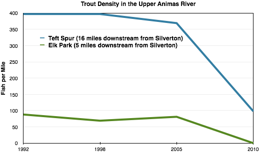
This is probably one of the clearest, simplest arguments in favor of water treatment of acid mine drainage there is. Water draining from mines in upper Cement Creek had been treated for years by Sunnyside Gold Corp. Then, in 2005 (via a complicated series of events detailed in River of Lost Souls) treatment stopped. The results were seen very soon after in fish populations miles downstream.
Knowing which springs are naturally acidic and metal-loaded is important, because it helps scientists formulate a picture of what pre-mining water looked like, and therefore they know what can be achieved by remediating mines. It also helps them decide which mines to focus on.
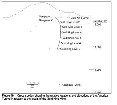
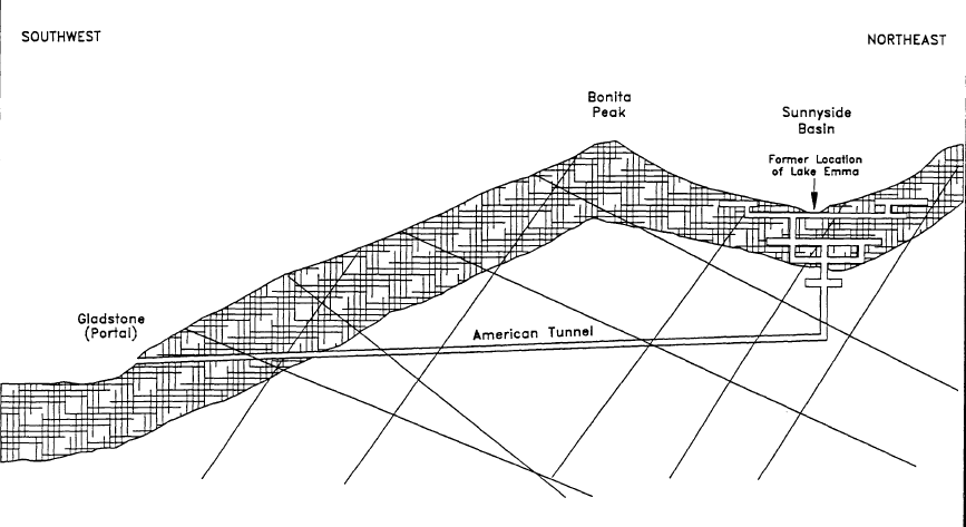
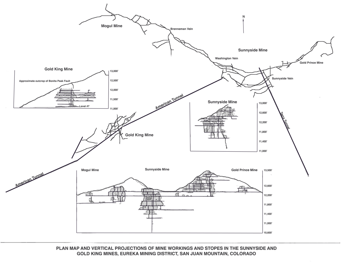
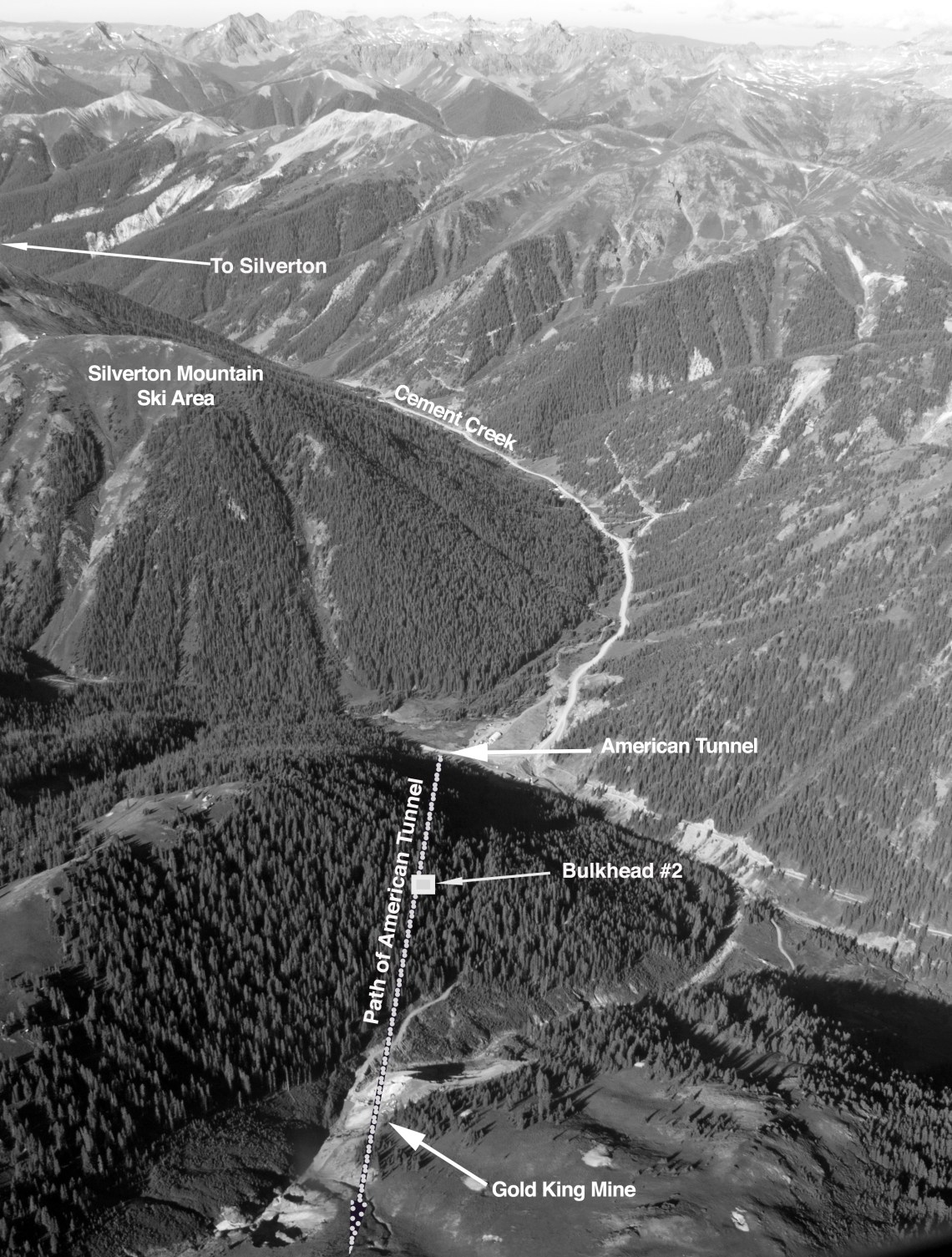
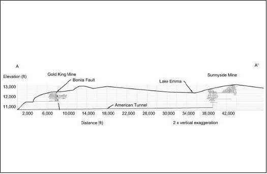
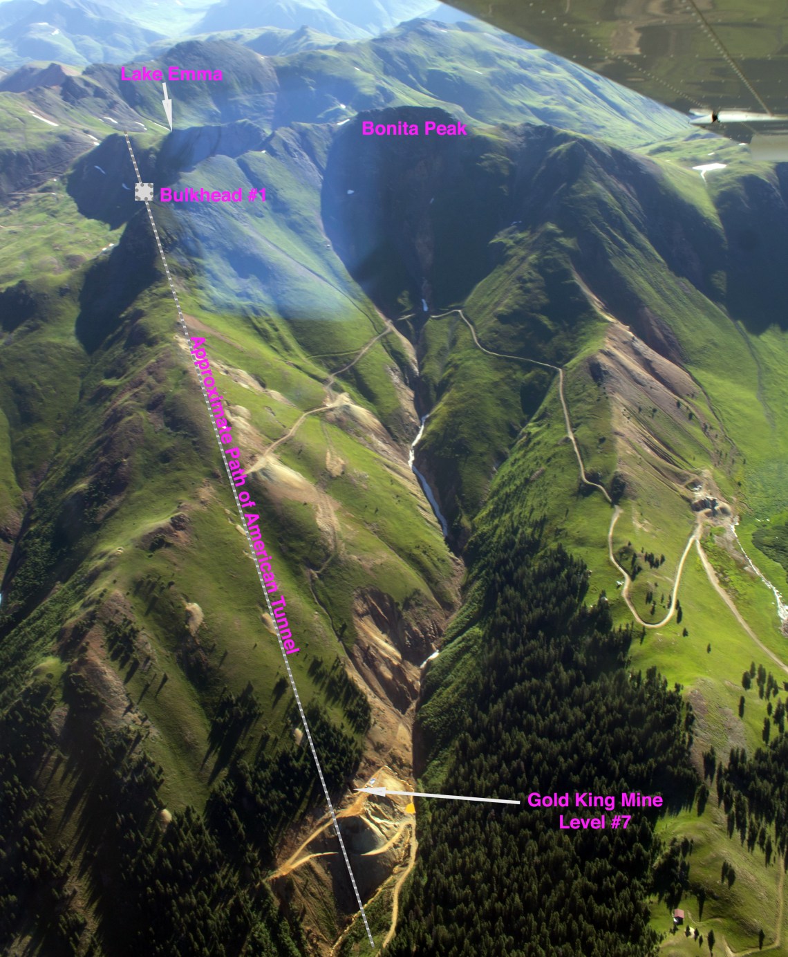
The placement of the American Tunnel and Sunnyside Mine workings, in relation to the Gold King, is crucial to understanding how bulkheading — or plugging — the American Tunnel may have affected the drainage from the Gold King. These diagrams will help readers with the latter chapters of River of Lost Souls.
The American Tunnel was originally driven in order to provide a lower, safer access to the Gold King Mine. Miners drove straight into the mountain at an upward angle, beginning at Gladstone. They would then go straight up to join the Gold King workings. The connection was never made, and the American Tunnel was later driven far deeper to access the Sunnyside Mine workings. An already confusing situation is made more so by the fact that two American Tunnels were drilled, the first being what is now called Gold King Mine Level #7.
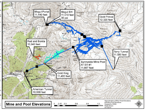
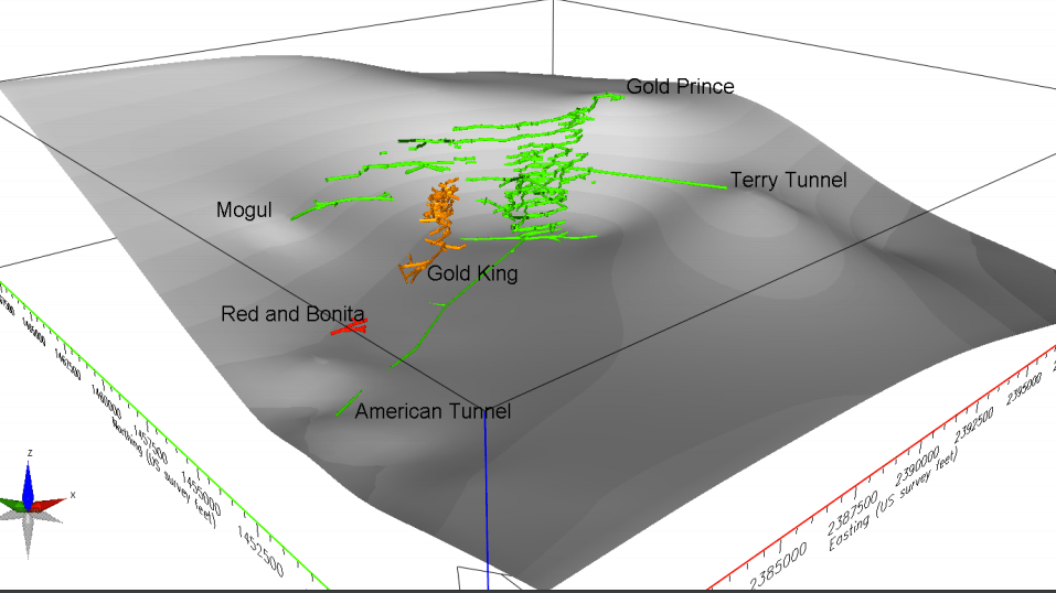
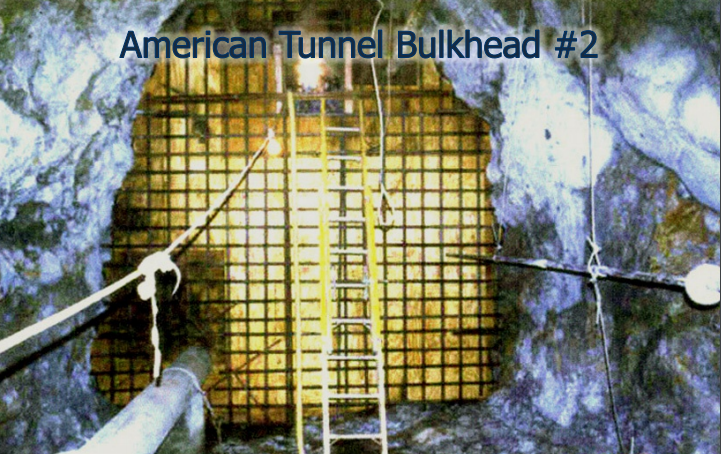
American Tunnel Bulkhead #2 backs water up into the mid-section of the American Tunnel. Assuming that the plugging of the tunnel is a cause of Gold King water discharges, then Bulkhead #2 is the most likely culprit. It may have returned the flow of groundwater to its pre-American Tunnel course (see historic photos below, showing drainage from Gold King Mine).After 1961, miners accessed the Sunnyside Mine via the American Tunnel, taking them directly below the Gold King workings. But the Sunnyside Mine itself is removed from the Gold King workings by thousands of feet of rock, making it seem unlikely that water from the Sunnyside Mine Pool is making its way to the Gold King. It’s more likely that the water, backed up behind Bulkhead #2, is getting into the Gold King via the Bonita Fault.This 3D map, put together by the State of Colorado Division of Mine Reclamation and Safety, was an attempt to better understand where the water in the Gold King, Red and Bonita, and Mogul mines originates.Sunnyside Gold Corp. installed three bulkheads in the American Tunnel. Bulkhead #1 traps water in the Sunnyside Mine workings deep underground, and Bulkheads #2 and #3 are closer to the surface, intended to stop drainage that enters the American Tunnel below the mine workings.
GOLD KING MINE PHOTOS
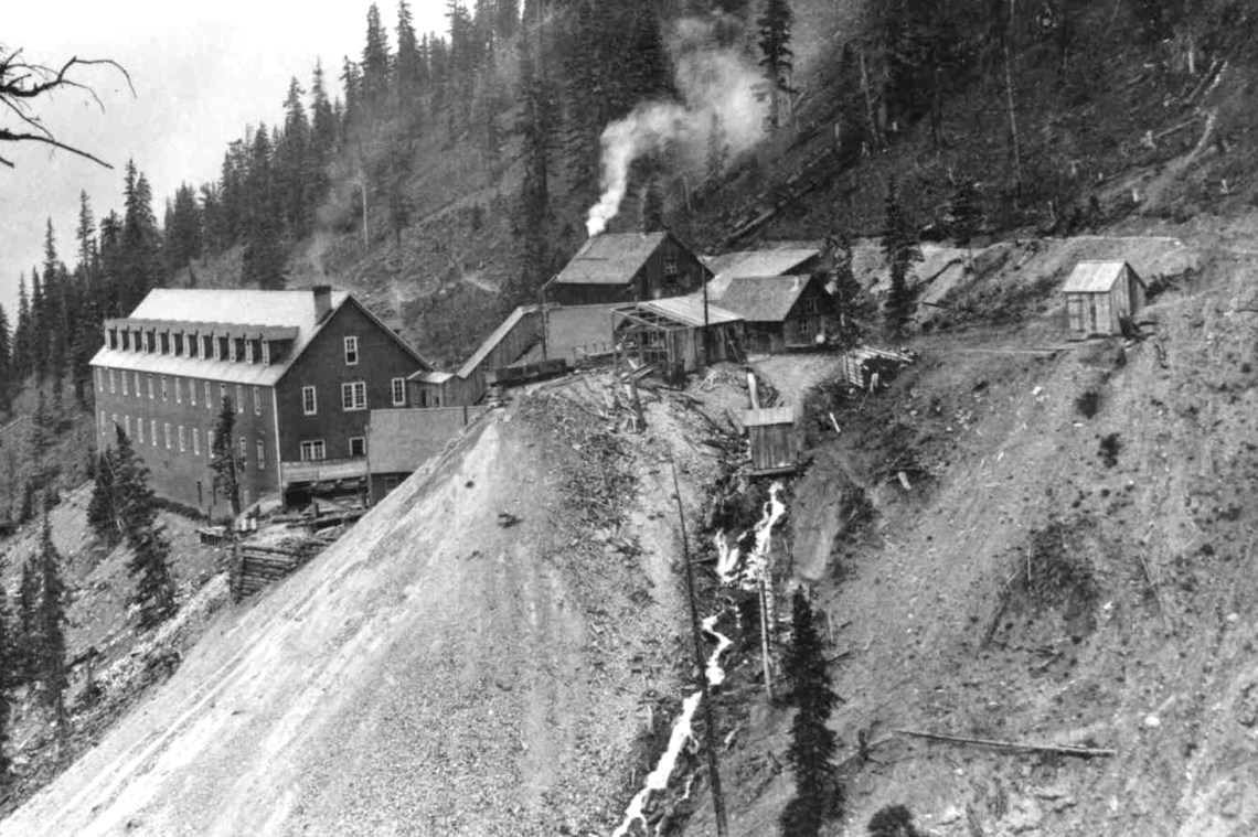
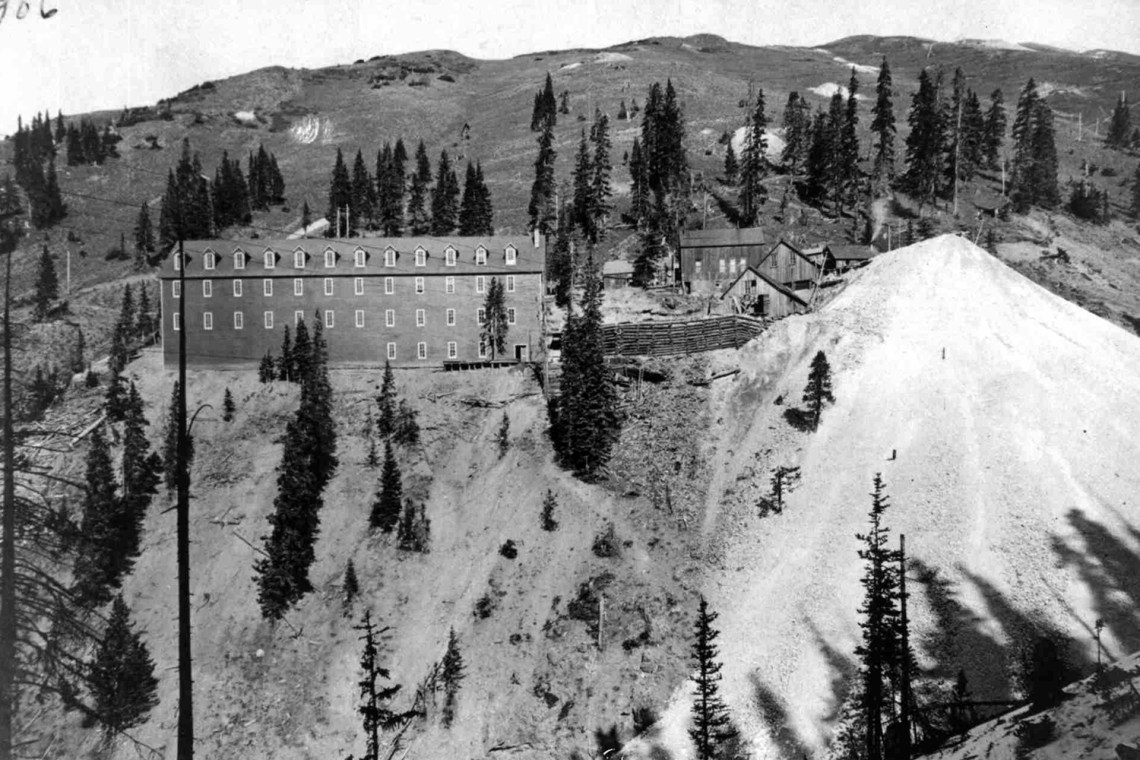
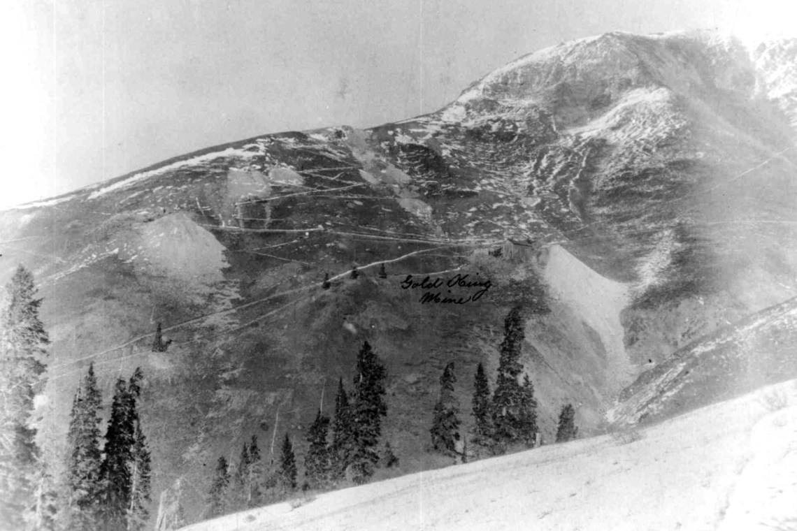
Gold King Mine adit, Level #7, in the early 1900s. Note the water draining from the mine next to the waste rock dump. After the American Tunnel was built, the drainage stopped, and didn’t start up again until the American Tunnel was plugged in the late 1990s and early 2000s.This is another view of the boarding house circa 1906. Note how big the boarding house was — it had to accommodate a lot of miners. A big fire in 1908 destroyed these structures and killed six people.This is also the Gold King, but from an earlier time period, when the main entrance to the mine was at a higher elevation than in the 1906 pictures. Note three mine dumps; the top two are probably from the Sampson mine, which was folded into the Gold King, and the lower one on the right is the Gold King. Level #7 was just out of the photo to the left.This aerial photo was taken four days after the Gold King Mine blowout of Aug. 5, 2015. The mine dumps above Level #7 are from the earlier Gold King and Sampson mine adits and match up with the ones seen in the historic photo above.
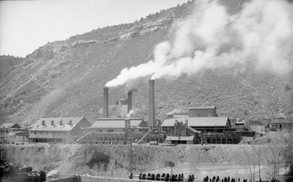
DURANGO SMELTER AND URANIUM MILL
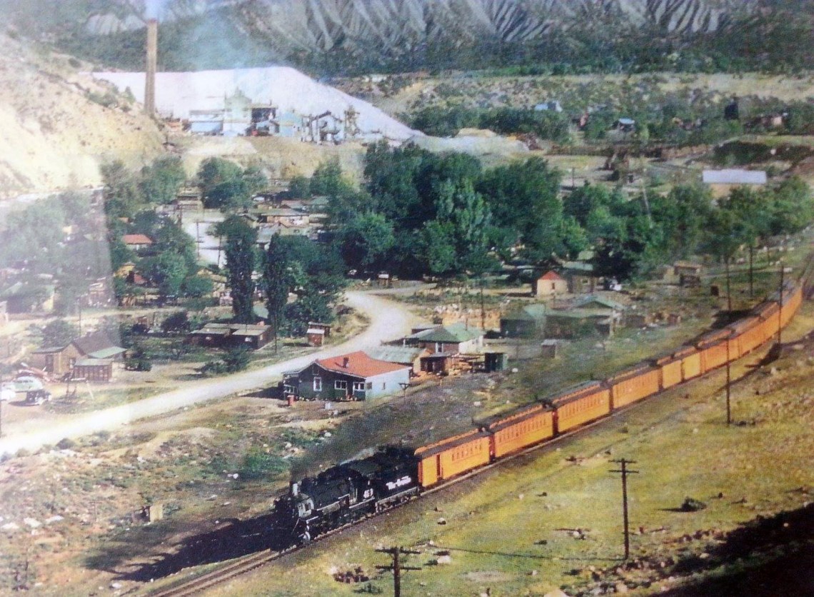
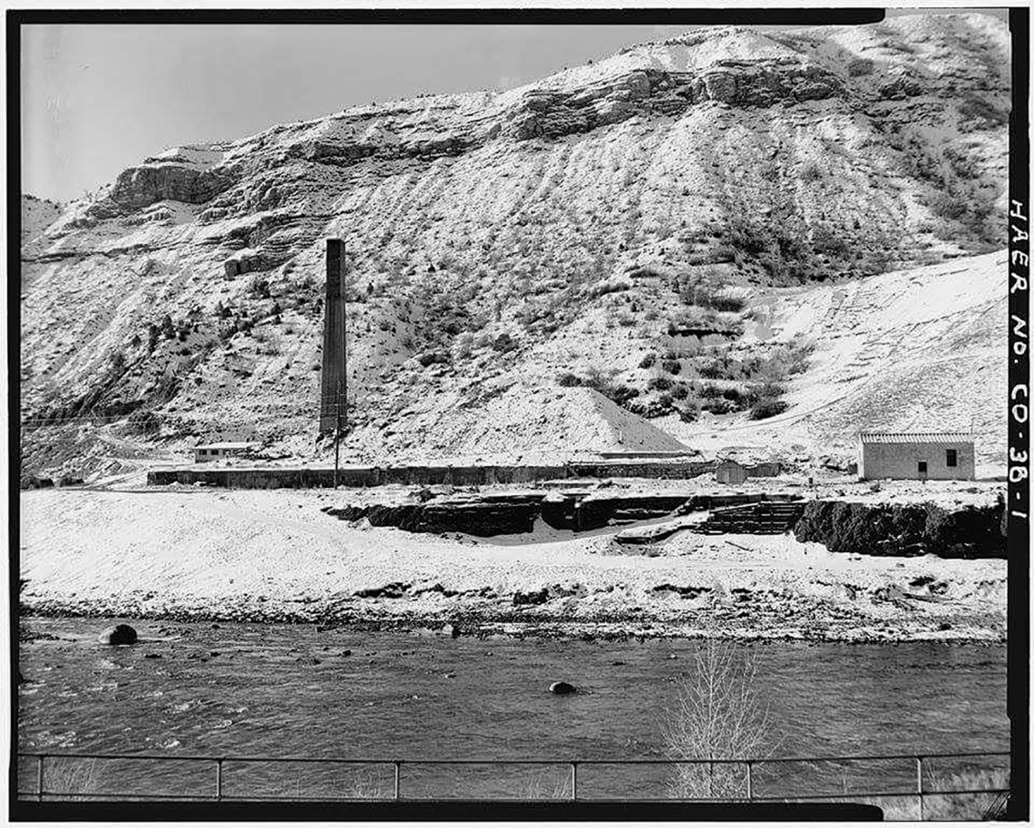
The Durango Smelter on the south edge of town, running full blast back in the early 1900s.In the 1940s, the smelter, by then shut down, was converted into a uranium mill for processing the materials that would be used in the bombs dropped on Hiroshima and Nagasaki in 1945. It continued as a uranium mill until 1963. Note the huge pile of uranium tailings behind the smokestack. In the foreground is the Santa Rita neighborhood — aka “The Flats.” And that train was probably headed to Alamosa via Chama.The uranium mill dumped a lot of radioactive crap into the Animas River, resulting in downstreamers getting a fat dose of radium in their drinking water.This is what was left of the smelter/uranium mill in the early 1980s, prior to cleanup. The smokestack was demolished in 1987, and the huge tailings pile was moved to a depository behind Smelter Mountain.
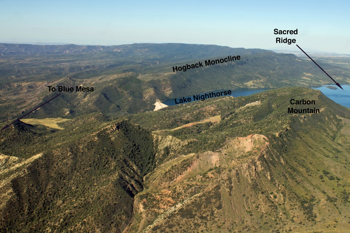
CARBON (a.k.a. MOVING) MOUNTAIN
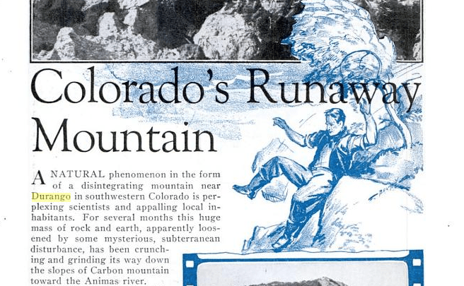
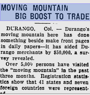
Carbon Mountain, just south of Durango, has long been a center of activity. One of the largest Pueblo I communities in the region was located near it in the 8th century. In the 1930s, the mountain — part of the Hogback Monocline — garnered national attention when it “erupted,” possibly due to methane coming into contact with underground coal seam fires. Now it looms over Lake Nighthorse, and has hydrogen sulfide and methane seeps at its base.When Carbon Mountain came to life in the 1930s, it was a big deal, drawing national and even international attention and gawkers. This is from Popular Science.
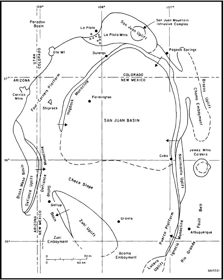
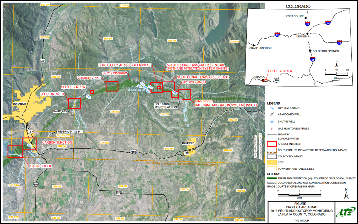
This map shows the geologic San Juan Basin and its surroundings. Carbon Mountain is part of the Hogback Monocline, which forms the boundary of most of the Basin.The red-boxed “areas of interest” in the map indicate areas along the Hogback Monocline where geologic methane seeps are being monitored. The Basin Creek seep on lower left is at the base of Carbon Mountain. The most prolific seeps are probably those at Texas Creek, where a small power plant has been set up to capture methane and burn it to generate electricity.
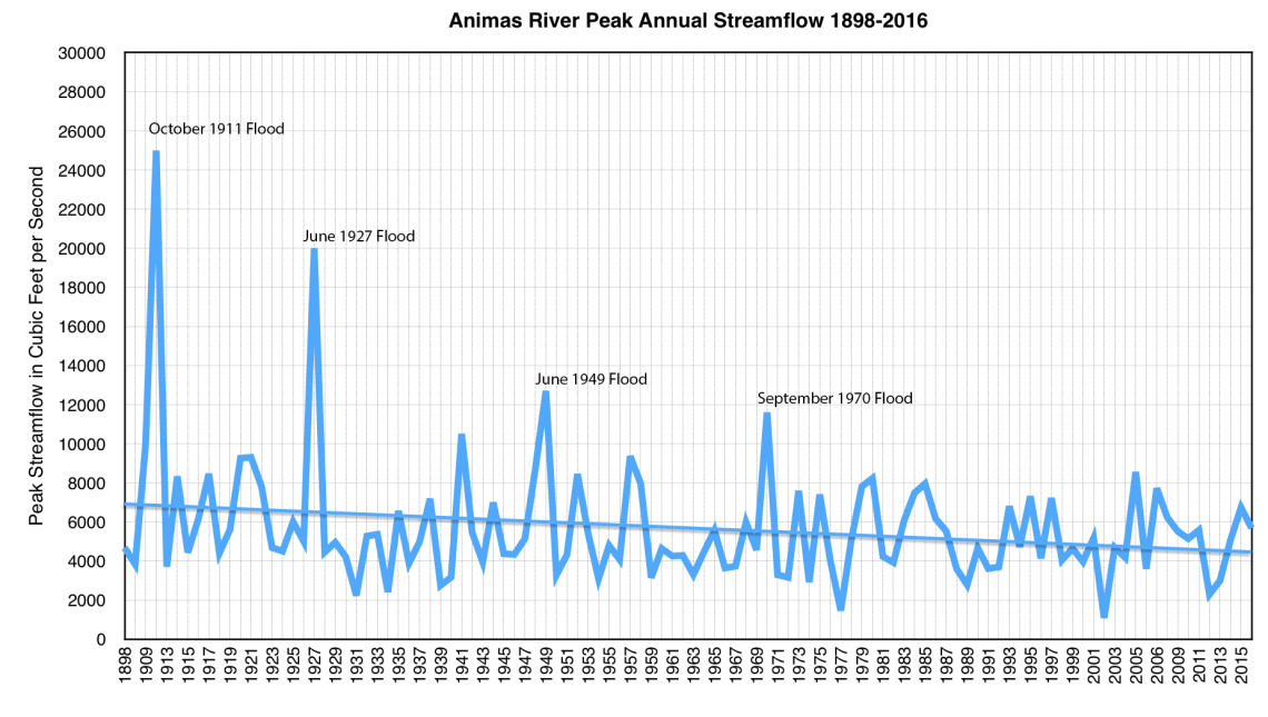
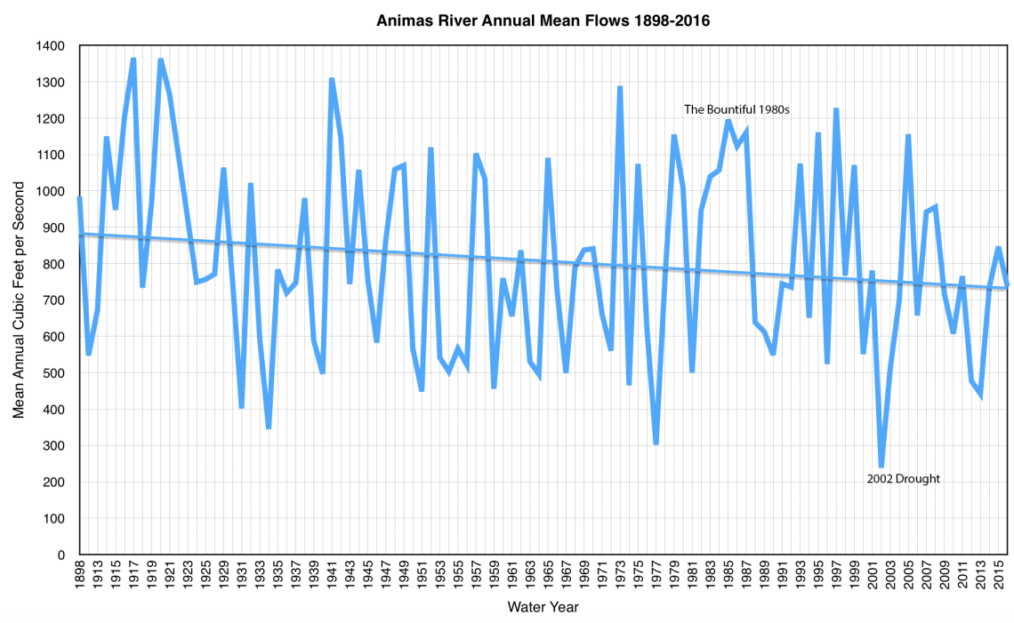
1911 FLOOD
The peak and mean flows of the Animas River have been slowly declining over the past century and a half. Does that mean we won’t ever see another flood like the one that tore through the region in 1911? These streamflow figures are from the Durango gage in the middle of town.
SLIME WARS and MINE TAILINGS
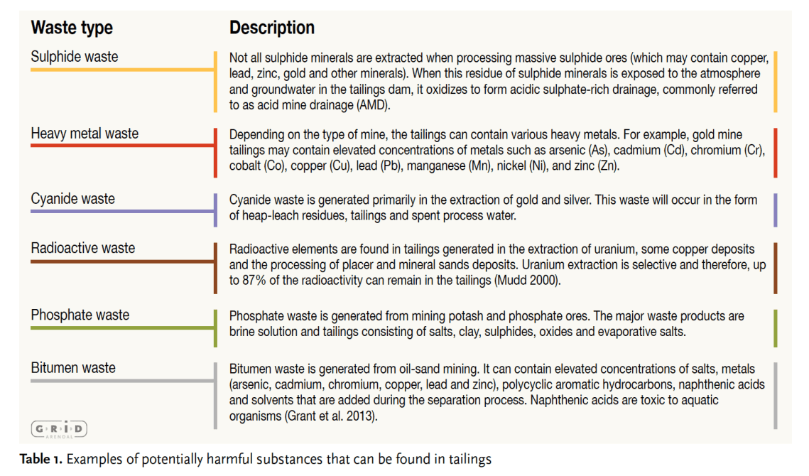
The “Slime Wars” may have ended in the San Juan Mountains, but they rage on in other parts of the nation and the world on a far, far bigger scale. Some of the worst mine disasters in recent decades — catastrophes that make the Gold King spill look puny — have involved tailings dam breaches. The United Nations Environment Program put out a report in December 2017 looking into this issue. It’s disturbing and important reading. Below are a few of the graphics from the report that help give an idea of how enormous the problem is.
SAN JUAN RIVER OIL SPILL
In October 1972, a pipeline carrying crude from the Aneth Oil Field busted, spilling 285,000 gallons of oil into the San Juan River near Shiprock. These are photos from the cleanup of the spill, one of the first major actions undertaken by the then-new Environmental Protection Agency. These are some EPA photos of the cleanup, at the beginning of Lake Powell, some 200 miles downstream from the spill.
Landscape
Landscape
Landscape
Landscape
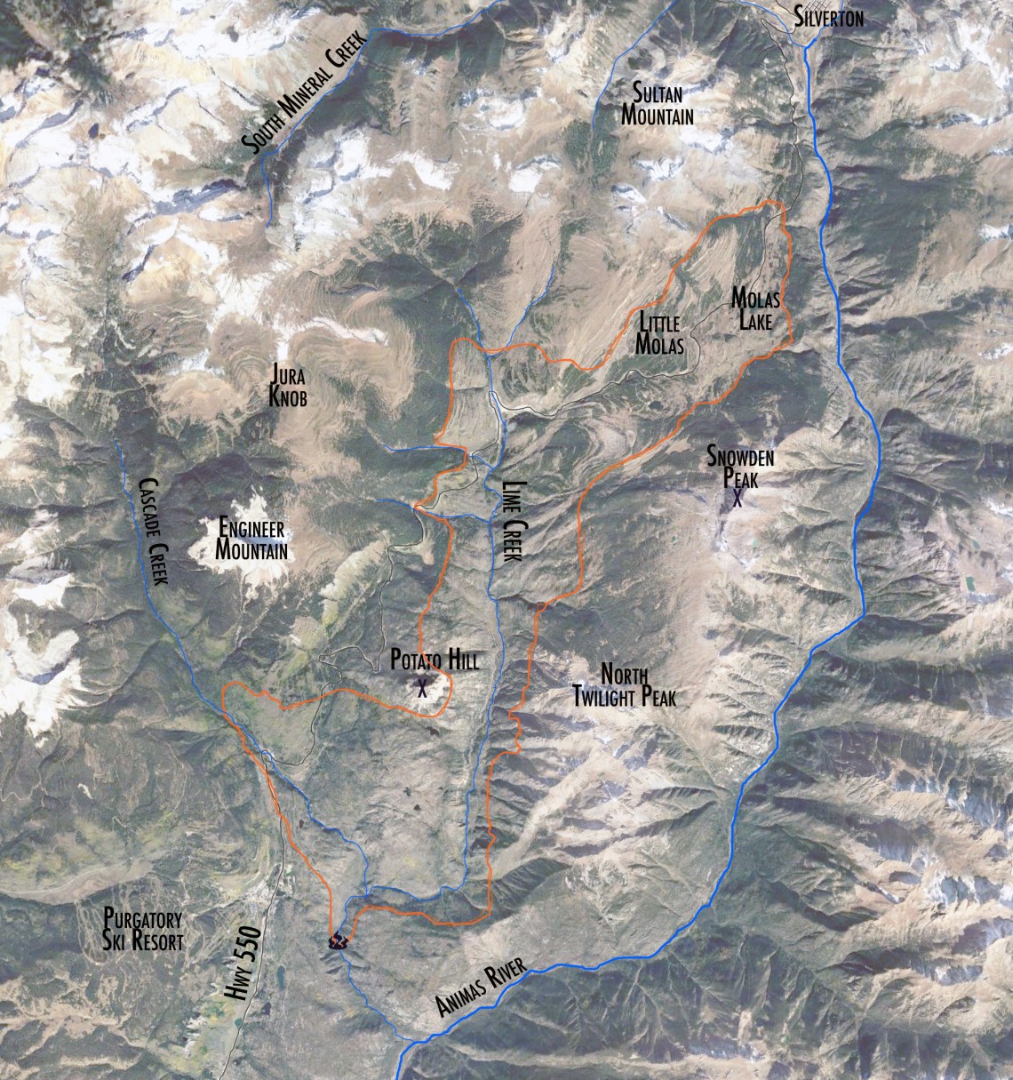
LIME CREEK BURN
The orange line marks the approximate perimeter of the 1879 Lime Creek Burn area, which charred 26,000 acres and stood as the largest fire on record in Colorado until 2000. Prior to the fire, the area around Molas Lake was densely forested. Now it’s wide open and grassy, and charred stumps are still apparent even now, nearly 140 years later. Parts of the area were replanted, in some cases with non-native Scotch Pine, which is why the forest along Highway 550 near Andrews Lake looks kind of strange.