The greater Chaco region covers a good portion of the San Juan Basin, which has historically been one of the biggest natural gas fields in the nation. More recently horizontal drilling and multi-stage hydraulic fracturing — a.k.a. fracking — has come to the region, further threatening the natural and cultural resources and the people who live there.
The following are images made by Jonathan P. Thompson over the past decade or so. All are available for reprint with permission. Please contact Jonathan@RiverOfLostSouls.com for information and rates.
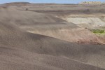
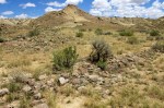
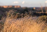
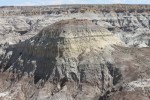
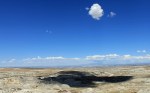
Landscape detail in the badlands that Georgia O’Keefe often painted, calling it the “Black Place.” There are several oil wells amongst these badlands.
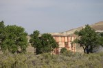
Art on building near Lybrook.
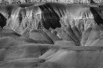
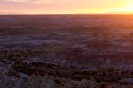
Badlands near Georgia O’Keefe’s “Black Place,” surrounded by oil development.
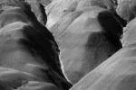
Badlands near Georgia O’Keefe’s “Black Place.”
Badlands at Georgia O’Keefe’s “Black Place.”
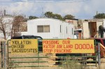
Poster on the wall of the Ojo Encino Chapter House. Chapters are the most local political subdivision of the Navajo Nation, and they have taken a leading role in the fight against oil and gas drilling.
Daniel Tso is a former Navajo Nation tribal council delegate and has long watchdogged the oil and gas industry in this region.
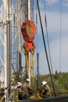
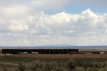
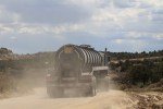
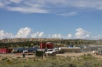
A constant stream of trucks went in and out of this drilling site during a major frack job in August 2017.
Horses and a pumpjack near Pierre’s Site.
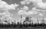
A line of natural gas wells and associated tanks leading up to Huerfano Peak, or Dzil Na’oodilii, a significant spot in the Navajo world.
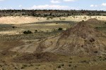
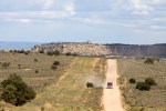
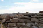
Pierre’s site (with structures on the conical hilltop and at its foot), as viewed from the Acropolis. Note drilling rig in background right.
Oil and gas infrastructure is woven into the landscape of the San Juan Basin. Late light catches this equipment, with Huerfanito Peak in the background.
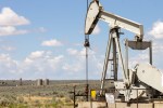
Pumpjack near Pierre’s Site, a major Chacoan outlier about 10 miles outside the park boundary.
Much of the drilling and fracking is done by contractors that may come from as far away as Texas or Wyoming. When locals are hired for the well-paying jobs, the money doesn’t stick around in the rural communities because there’s no economic infrastructure in place for capturing the cash and leveraging it for the benefit of the community.
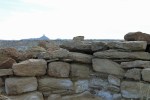
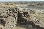
Pumpjack visible between lichen-covered masonry blocks at Pierre’s Site. Though the structures here are protected, the ambience is not.
Most of the recent oil drilling in the Chaco region has been done by WPX Energy, an Oklahoma-based company. The company recently sold all of its San Juan Basin assets.
The recent oil boom has resulted in a major uptick in truck traffic on the clay roads of the area. The roads are hard and dusty when dry, but turn into muddy, slippery messes in the rain.
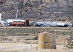
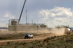
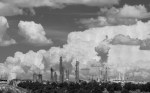
Lybrook natural gas processing plant.
Lybrook natural gas processing plant.
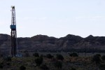
A natural gas well on the badlands below Angel Peak.
A water tower in the fields of the Navajo Agricultural Projects Industry is silhouetted against evening sky.
Truck traffic jams are a not uncommon occurrence on the clay roads near Chaco.
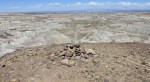
A possible Chaco-era shrine atop a mound above Kutz Canyon, at what may be the northern terminus of the Great North Road. The La Plata Mountains can be seen in the distance.
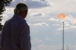
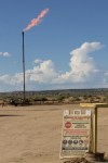
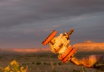
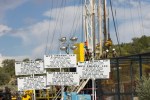
Newly drilled wells are “flared,” meaning that methane, nitrogen gas used in fracking, and other undesirable byproducts are burnt off.